What is the Lidar Range and How Does it Work?
Lidar technology has revolutionized the way we measure distance. Central to this innovation is the concept of Lidar Range. It defines how far Lidar sensors can accurately detect objects. This capability is vital in various industries, from autonomous vehicles to environmental monitoring.
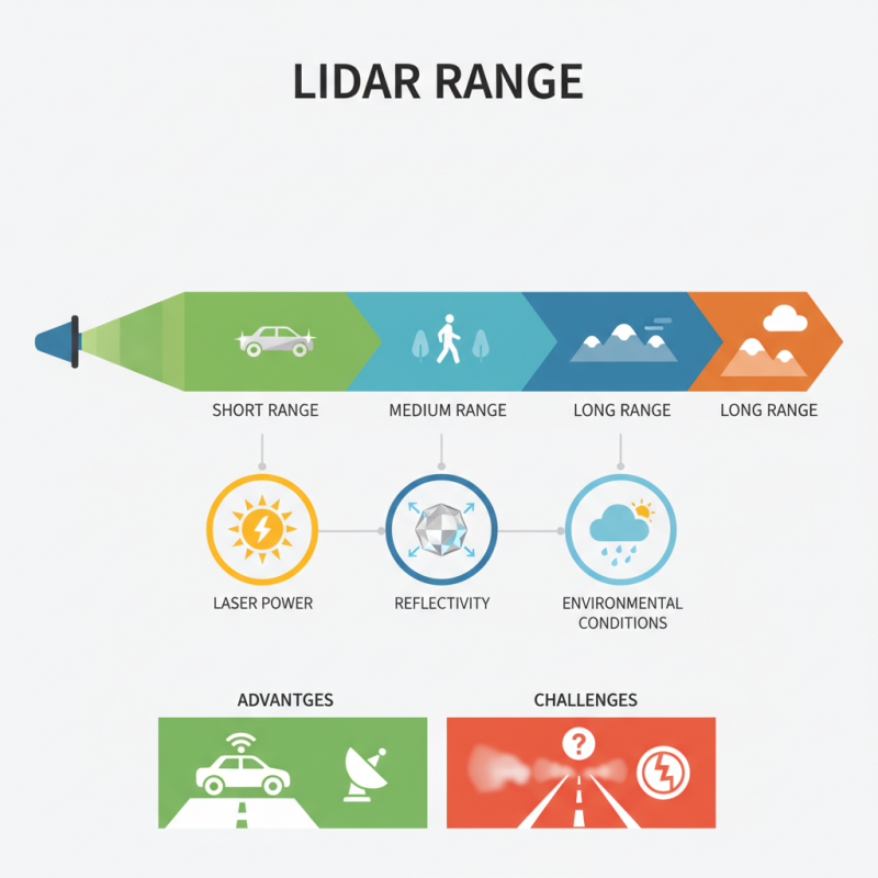
Lidar Range is influenced by several factors. These include the power of the laser, the reflectivity of objects, and environmental conditions. For example, a highly reflective surface can improve detection. In contrast, adverse weather may reduce effectiveness. This complexity can be both an advantage and a challenge.
Understanding Lidar Range is essential for maximizing its potential. Yet, people often overlook its limitations. Misjudgments can lead to underestimating the technology's capabilities. Therefore, careful evaluation in real-world scenarios is critical. As we explore Lidar Range, we must reflect on its practical applications and limitations.
What is Lidar? An Overview of the Technology
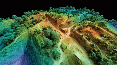
Lidar, or Light Detection and Ranging, is a transformative technology. It uses lasers to measure distances. By shining laser beams at targets and measuring the time it takes for the light to return, Lidar creates precise, three-dimensional information. This information can outline landscapes or structures in great detail. According to a recent industry report, the global Lidar market is projected to grow to $2.5 billion by 2025.
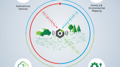
Lidar technology plays a significant role in various sectors. In forestry, it assesses tree height and density. In autonomous vehicles, it helps navigate surroundings. A 2022 study showed a 25% increase in accuracy for aerial mapping when using Lidar systems. Yet, Lidar can have limitations, such as poor performance in heavy rain or fog.
Tip: When choosing Lidar systems, consider environmental conditions where they will be used. Not all Lidar systems perform equally in all weather. Understanding these aspects can enhance project outcomes.
Another important point is cost. Lidar systems can be expensive, sometimes not fitting smaller project budgets. It's worthwhile to compare and analyze available options. Innovation continues to reshape Lidar capabilities, making it essential for future developments.
Understanding Lidar Range: Definition and Measurement
Lidar range refers to the maximum distance that Lidar systems can accurately measure. This range is critical for various applications, including autonomous vehicles and environmental mapping. Typically, Lidar can measure distances from a few centimeters to several hundred meters, depending on the wavelength and pulse characteristics. Recent reports indicate that the effective range can vary significantly, with some systems achieving ranges up to 1,000 meters in ideal conditions.
Understanding how Lidar measures distance involves the time-of-flight principle. A laser pulse is emitted and its reflection off an object is detected. The system calculates distance by timing the round trip of the pulse. This method provides high precision, but environmental factors like fog or rain can reduce performance. A study published by the IEEE highlights that weather conditions can decrease accuracy by 20% or more. Such challenges remind us that while Lidar technology is advanced, it isn't foolproof.
In practical applications, this range limitation impacts data collection strategies. For instance, in forest monitoring, the ability to penetrate dense foliage affects measurements. Research indicates that Lidar can miss layers of vegetation, leading to underestimation of tree density by up to 30%. These nuances illustrate the importance of understanding Lidar range and its constraints for accurate data interpretation.
Lidar Range and Measurement Data
| Lidar Type |
Max Range (meters) |
Accuracy (cm) |
Measurement Frequency (Hz) |
Applications |
| Solid-State Lidar |
200 |
5 |
10 |
Autonomous Vehicles |
| Mechanical Lidar |
150 |
3 |
5 |
Mapping, Forestry |
| Pulsed Lidar |
300 |
10 |
20 |
Surveying, Agriculture |
| Frequency Modulated Continuous Wave Lidar |
1000 |
1 |
50 |
Environmental Monitoring |
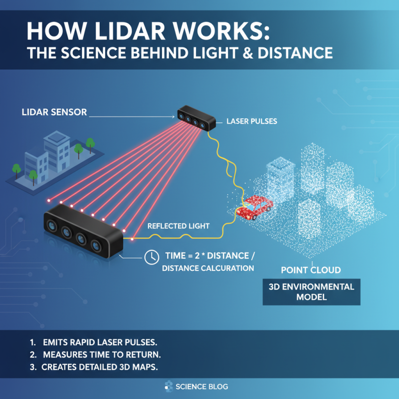
How Lidar Works: The Science Behind Light and Distance
Lidar, short for Light Detection and Ranging, operates on a simple yet fascinating principle. It uses laser light to measure distances. The system emits rapid pulses of light. These pulses bounce off objects and return to the sensor. By calculating the time it takes for the light to travel to the object and back, Lidar accurately assesses distance. This method creates detailed, three-dimensional models of environments.
Understanding how Lidar works involves delving into the science of light. When the laser pulse hits a surface, it reflects back at a precise angle. The quality of that reflection depends on the surface material. Some materials absorb light, while others reflect it strongly. This variability can lead to challenges in data collection. Factors like weather, surface conditions, and angles significantly impact results.
In practical applications, Lidar plays a vital role in many fields. It's used in geography, archaeology, and autonomous vehicles. Each application demands different levels of precision and data quality. However, the technology is not without flaws. In some environments, like dense forests, data might be less reliable. Understanding these limitations is crucial for effective Lidar usage.
Factors Affecting Lidar Range and Accuracy
Lidar technology relies on light pulses to measure distances. However, several factors can significantly impact its range and accuracy.
Weather conditions, such as fog, rain, or snow, can scatter the laser light.
This scattering results in reduced signal strength, leading to distorted readings. Bright sunlight can also interfere with sensors. In such scenarios, the chances of inaccuracies increase.
Another influence on Lidar performance is the surface reflectivity. Some materials, like concrete, reflect laser beams well. Others, like water or dark asphalt, absorb them, causing weak signals.
The angle of incidence matters too. A tilted surface may reflect light away from the sensor, leading to incomplete data.
Lastly, the system's calibration plays a crucial role. An improperly calibrated device may produce misleading results. Regular adjustments can enhance reliability but are often overlooked.
These factors highlight the need for careful consideration when utilizing Lidar technology. It's essential to be aware of these limitations.
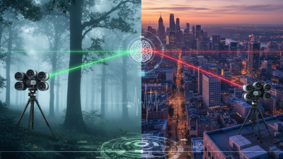
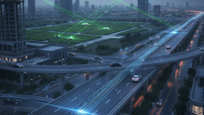
Applications of Lidar: Uses in Various Fields
Lidar technology has found widespread applications across various fields. In agriculture, it helps in creating detailed topographical maps. Farmers use these maps to assess land use patterns. This data supports precision farming, allowing them to optimize resources. Capturing light reflections from crops, Lidar provides insights into plant health. The data can also indicate where to plant or apply water.
In urban planning, Lidar scans cities and structures. It assists in mapping infrastructure and optimizing public transport routes. City planners analyze these results to enhance urban designs. Environmental monitoring benefits as well. Lidar tracks changes in habitats and landscapes. For example, it can detect deforestation or urban sprawl. The technology can pinpoint areas needing conservation efforts.
Despite its advantages, Lidar is not without challenges. Data processing can be time-consuming. Accuracy depends on multiple variables like weather and angle of collection. Misinterpretations might occur if data isn't verified. Users must remain cautious in their analyses. Advances are promising, yet a critical eye is essential for better results.
Lidar Applications Across Various Fields